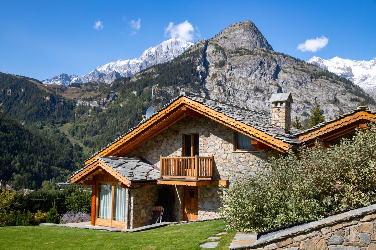
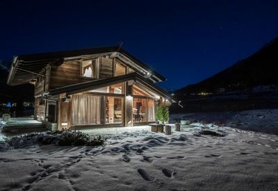
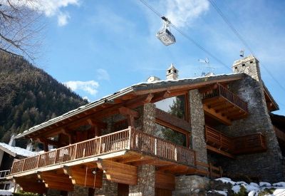
 Architettura Alpina
 Elementi costruttivi del paesaggio
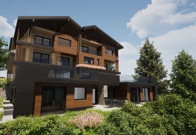
 Progettazione di attività produttive e commerciali
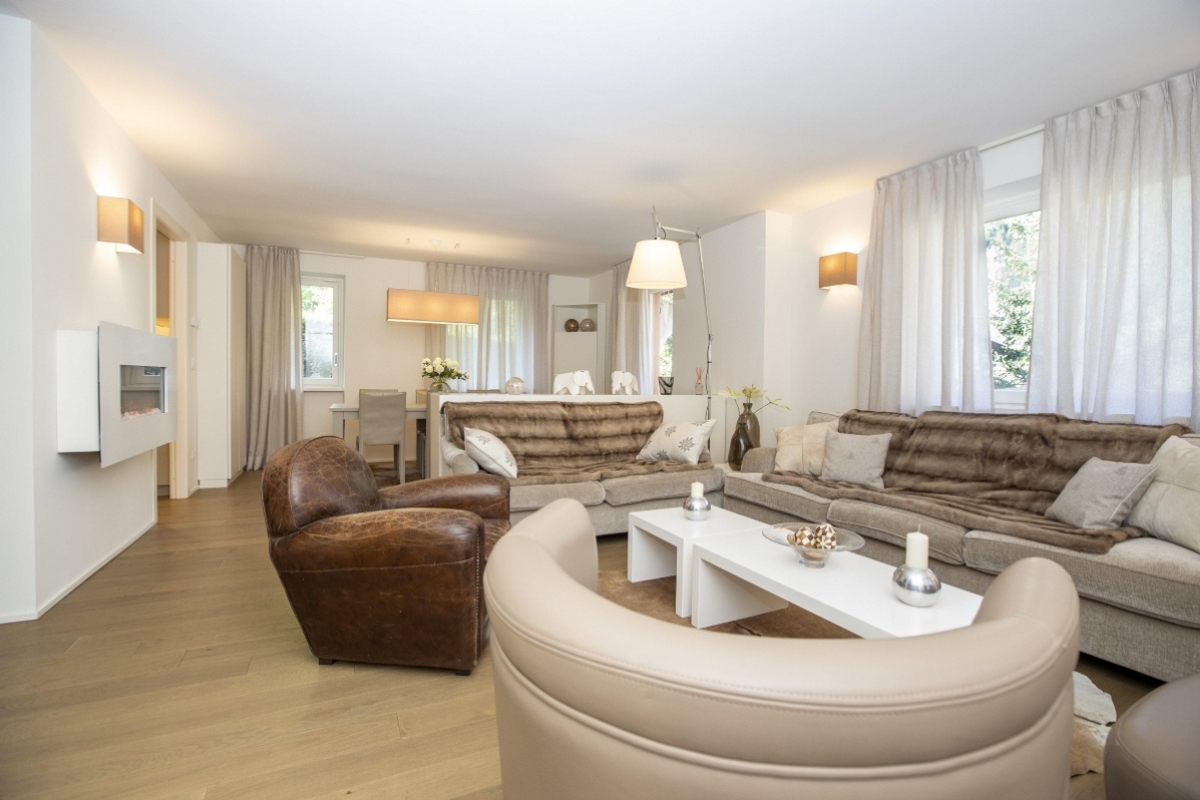
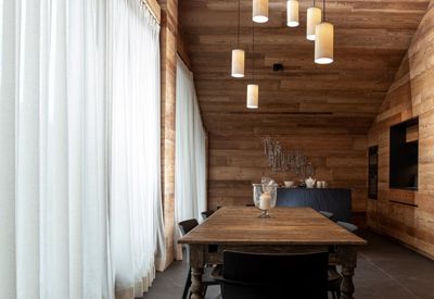
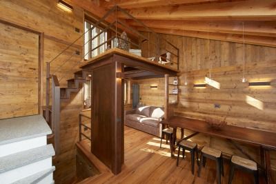
 Interior Design
Interni di pregio
Interior Design
Interni di pregio
 Architettura Alpina
Realizzazione rifugi
Architettura Alpina
Realizzazione rifugi

 Capacità progettuale a 360°
Musumeci S.p.A. - Stabilimento tipografico
Capacità progettuale a 360°
Musumeci S.p.A. - Stabilimento tipografico
 Progettazione edifici e strutture per la cultura e il turismo
Museo Alpino Duca degli Abruzzi
Progettazione edifici e strutture per la cultura e il turismo
Museo Alpino Duca degli Abruzzi
 Realizzazione autorimesse interrate e sistemazione viabilità
Sistemazione veicolare e pedonale ingresso Courmayeur e autorimessa interrta
Realizzazione autorimesse interrate e sistemazione viabilità
Sistemazione veicolare e pedonale ingresso Courmayeur e autorimessa interrta
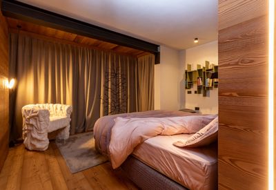
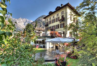
 Ville e dimore di pregio
For more than 40 years your home
has been the center of our project

COURMAYEUR
Strada Margherita, 23A
11013 Courmayeur (AO)
T. +39 0165 84 66 83
F. +39 0165 84 63 63
M. info@inart.it
PEC inartsrl@pec.it
P.IVA : 00143770071
AOSTA
Corso Lancieri, 2/E
11100 Aosta
T. +39 0165 84 66 83
F. +39 0165 84 63 63
M. info@inart.it
PEC inartsrl@pec.it
P.IVA : 00143770071

Valid XHTML 1.0 Strict • Valid CSS! • VisaMultimedia - Grafica | Internet | Multimedia | Video | Fotografia • Cloud Hosting Provider - HEXTRA